Description of Storm Surge Animations
When strong winds blow over the surface of the sea, wind-driven currents are produced and over time, water may pile up against the coast, or be blown offshore, depending on the direction, intensity and duration of the wind. The former is known as a positive storm surge; the latter as a negative surge. The surge resulting from hurricanes and winter nor'easters may be quite different in location, height, onset and duration; each storm is unique with its own peculiar characteristics or signature.
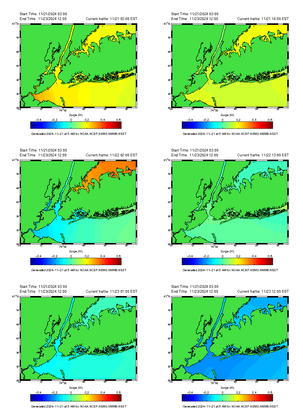
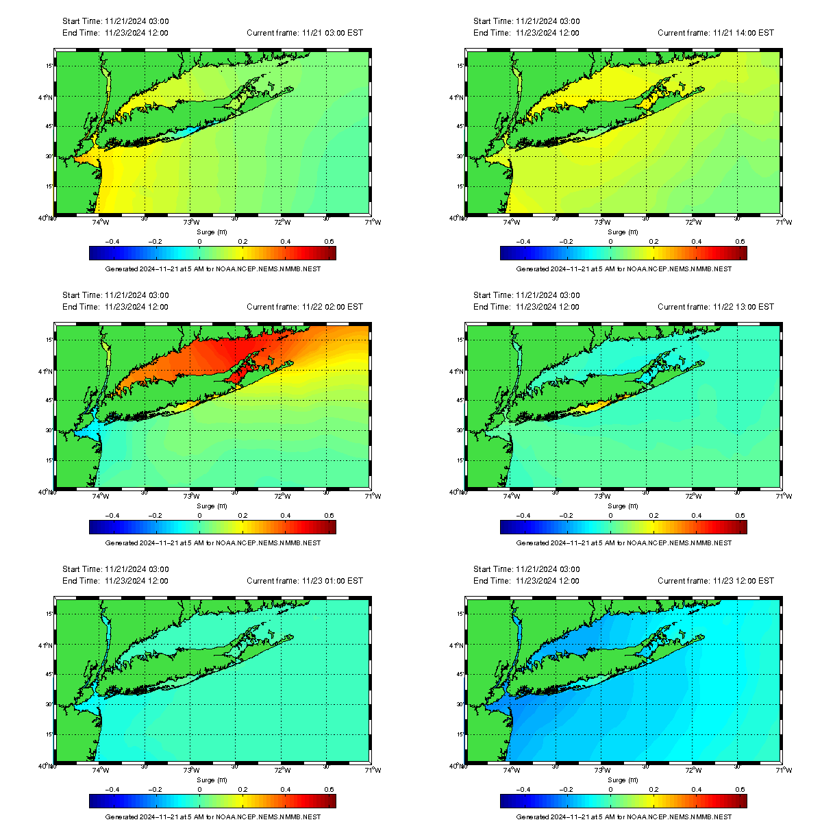
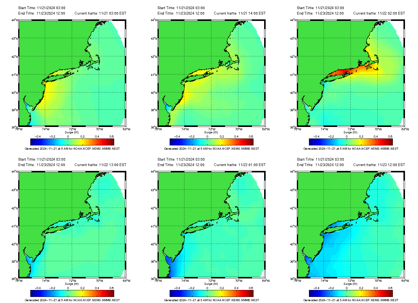
These animations, presented at three different scales, display predictions of coastal storm surges over the northeastern seaboard, with a focus on the New York Bight, Long Island Sound and metropolitan New York. The twice-daily rise and fall of the tides (known as the semi-diurnal astronomical tides) are controlled by the relative movements of the earth, the sun and the moon, and have been subtracted from these images. The resulting colors represent the height of the sea surface above or below mean sea level (the mean or average occurs when the region is experiencing good weather with little or no winds).
These predictions are of 60-hour duration, and are updated and reset twice a day, at approximately 5 am and 5 pm Eastern time. The running clock in the upper right of the frame counts the elapsed time since the last forecast in increments of 1 hour.
The color bar at the bottom of the frame is the scale for the surge, expressed in meters (one meter is about 39"). This is a dynamic scale, which automatically adjusts each day to encompass the varying range of the surges, according to each day's anticipated weather patterns.
Maximum Predicted Surge
These three plots display the maximum surges predicted over each region during the current 60-hour forecast, regardless of when the maximum surges will occur. Such plots are useful in learning where the worst surges are likely to be located, and to study their statistical variation in space and time.

Disclaimer: This is a research product still under development and should never be used for emergency management decisions relating to protection of life or property under any circumstances.


